星目探宇
科普知识大合集
星目探宇
首页
奇妙科普
天文摄影
星地对比
科普视频
活动专区
留言区
NASA资料馆
去登录
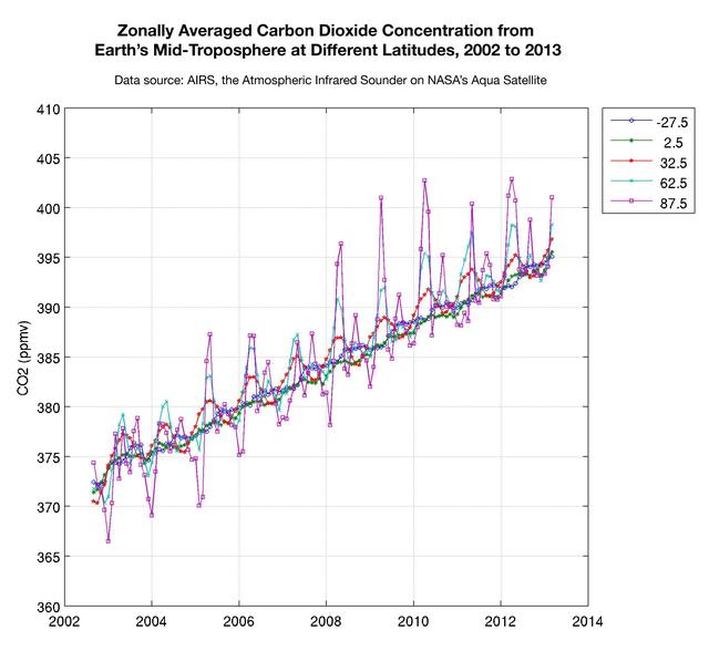
2002年至2013年不同地形下地球对流层中层纬向平均二氧化碳浓度
该图显示了美国宇航局Aqua卫星测量的不同纬度地球对流层中层二氧化碳浓度。彩色线代表绕地球的不同纬度带,称为区域。
Tags:
2013-05-22T19:23:25Z
,
This plot shows the concentration of carbon dioxide in Earth mid-troposphere at various latitudes as measured by NASA Aqua satellite. The colored lines represent different latitude bands that circle Earth, called zones.
,
大家在找
火星探测
机智号
200
台风
长征
2025
流星
浙江
海王星
航天飞机
星空
星云
木星
宇宙
创世之柱
创生之柱
射手座
风暴
地球
黑洞
顶部